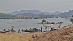
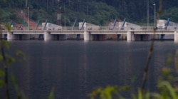
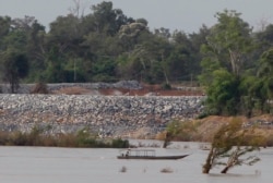
China and the countries of the lower Mekong River are teaming up for their largest joint study yet of the impacts climate change and hydropower dams are having on one of Asia's great waterways, and how to cope with the growing threats from floods and drought.
On Tuesday, the Mekong River Commission — an intergovernmental body comprising Cambodia, Laos, Thailand and Vietnam — announced a three-year study spanning the entire river basin, in tandem with Myanmar and the China-led Lancang-Mekong Cooperation Water Center, or LMC. Lancang is China's name for the Mekong.
From its headwaters in China's western highlands to its delta on the South China Sea, the Mekong courses over 4,000 kilometers through Myanmar, Laos, Thailand, Cambodia and Vietnam, supporting the livelihoods of 60 million people along the way.
A decade of increasingly erratic weather and ever-multiplying dams spanning both the river's mainstream and its tributaries have stifled the seasonal cycles of the Mekong that those millions rely on, said Anoulak Kittikhoun, the commission's chief strategy and partnership officer.
"So, there is a need to reassess the situation, and what's important is that the MRC cannot do that alone," he told VOA. "We need to cooperate with upstream countries, especially China and the LMC framework in order to have a common understanding about this change, and then to find out what immediate actions can be done in terms of coordinating the operation of the water infrastructure, as well as communication and notification mechanisms."
Devil in the details
The commission says the partners will formally launch the joint study in December, marking their largest collaboration yet by drawing on data from 1985 through 2019 at least, and not only from the Mekong's mainstream, the MRC's usual remit, but its main tributaries as well.
They will look at data from more than 30 years in two sets: one from 1985 to 2007, and another from 2008 onward, the latter capturing the main dam-building period. Anoulak said the split should give them a better idea of just what impact the dams have had on the river.
That has been a major point of contention between China and those who blame the record 11 dams it has built across the mainstream for much of the decline in downstream fish stocks and the sediment flows critical to floodplain farming. When U.S. climate research firm Eyes on Earth, after analyzing satellite data, said last year that the dams' massive reservoirs had worsened a devastating 2019 drought in the lower Mekong basin, China rejected the claim.
Many of the details of the study have yet to be worked out, from exactly which tributaries to focus on to how much data China will share on how it operates its dams. To date, China has refused to reveal how much water its dams release.
Anoulak said much of the study's success will hinge on how much operating data China and the other countries are willing to disclose.
"This is one of the keys to this study. In order to have the study recommend good measures for how the flow regime should be managed and how we can come up with adaptation measures, some of this data would need to be shared," he said.
More data from China on how it runs its dams will be vital to a full understanding of their effects on the lower Mekong and for any meaningful planning on how to best manage the river for the benefit of all, said Brian Eyler, Southeast Asia program director at the Stimson Center, a U.S. think tank.
"If this study is done right, then China will open up the books on how its dams have been operated from their point of commissioning or point of the reservoirs' filling," said Eyler, who also co-leads the center's Mekong Dam Monitor project.
Sharing that data would mark a sea change for China, he added, and whether it does so "remains to be seen."
Adapt vs. abate
Eyler welcomed the study's embrace of dams on the Mekong's many tributaries, which his own research suggests have a cumulative impact on the basin equaling that of those on the mainstream.
He said he is concerned, though, that China could use the collaboration as an opportunity to push the narrative that its dams' disruption of the Mekong's seasonal flood cycle actually helps downstream countries, despite a lack of evidence, and that some MRC officials make similar claims.
"Those forces could unite to further engineer the Mekong River system in a way that makes it harnessed, overmanaged and overengineered," Eyler warned. "And we know what the outcome of that process looks like. It looks like ecological breakdown in the Mekong, nearly entire loss of fisheries productivity, huge impacts on Vietnam's agricultural productivity and a large decrease in resilience of the Mekong delta to defend itself in the face of coming climate change impacts."
South of China, another 11 dams are either operating, under construction or in the planning phase on the mainstream alone, most of them in Laos. Dozens more straddle the river's tributaries.
Marc Goichot, Asia Pacific freshwater lead for the World Wide Fund for Nature, said he wonders whether the ultimate aim of the study is to merely help the Mekong countries mitigate harmful effects and adapt to them, or to avoid those it can and tackle the root causes.
Anoulak and the MRC's brief statement on the study referred more to mitigating and adapting, and to building better dams, rather than not building them.
Goichot, who is based in Vietnam, said he also is struck by the lack of any mention of sediment — the silt, soil and sand rivers pick up along their course and deposit downstream. Farmers depend on those deposits all along the Mekong, but nowhere more so than in the Mekong delta in the south of Vietnam, the country's rice bowl.
The delta has been sinking and shrinking for a lack of sediment for years, compounding the risks of rising sea levels and the fears of a coming exodus out of the densely populated area.
"It's the place that's most exposed to droughts and floods, and that's very relevant to hydropower because basically the delta is sinking much faster than sea levels rise, and sinking is attributed to some part, [an] important part, to the fact that the sediment from the Mekong has been reduced, and the dams are one of the key reasons, if not the key reason for why sediment has reduced so much," Goichot said.
"For me I would have expected this to be front and center already at this stage in the study, and it is not," he added.
The LMC did not reply to VOA's request for comment.


